Ujung Kulon


Ujung Kulon National Park is located at the western most trip of Java, Banten, Indonesia. It includes the volcanic island group of Krakatoa and other islands including Panaitan, Handeuleum and Peucang on the Sunda Strait. 

The park encompasses an area of 1,206 sq km (443 sq km marine), most of which lies on a peninsula reaching into Indian Ocean. The explosion of nearby Krakatoa in 1883 produced a tsunami (giant wave) that eliminated the village and crops of the coastal areas on the western peninsula, and covered the entire area in a layer of ash about 30 cm thick. This caused the total evacuation of the peninsula by humans, thereby allowing it to become a repository for much of Java's flora and fauna, and most of the remaining lowland forest on the island

Ujung Kulon National Park (6o45' S, 105o20' E) and Krakatoa Nature Reserve (6o06' S, 105o25' E) make up a World Heritage Site. Ujung Kulon National Park lies on the extreme south western tip of Java within the administrative province of Jawa Barat (West Java) and the Kabupaten of Pandeglang. 


The point to point ocean boundary encloses Ujung Kulon Peninsula and the offshore island of Pulau Handeuleum and Pulau Peucang, whilst the island of Pulau Panaitan is separated by the 10 kilometers wide Panaitan Straits. The eastern boundary follows contours along the eastern foothills of the Gunung Honje massive. Krakatoa Nature Reserve comprises the four islands of the Krakatoa group whichl lie some 60 kms to the north between Java and Sumatra. The reserve lies within Lampung administrative province, Sumatra.

Condition are tropical maritime, with a seasonal mean annual rainfall of approximately 3,249 mm. Heaviest rainfall is between October and April during the northwest monsoon, and a noticable drier periond occurs between May and September during the southeast monsoon. Mean monthly rainfall figures of 400 mm have been recorded for December and January, and 100 mm per month during May to September. Mean temperatures between 25oC to 30oC and relative humidity between 65% and 100%

Ujung Kulon is triangular peninsula protruding from the southwest extremity of mainland Java, to which it is joined by a low isthmus some 1 - 2 km wide. The topography is dominated in the southwest by the tree, north-south aligned ridges of the Gunung Payung massive, with the peak of Gunung Payung, Gunung Guhabendang and Gunung Cikuja, forming the highest point of the peninsula. To the northeast, the relief attenuates to the low rolling hills and plains of the Telanca Pateau, and ultimately to the low-lying swamps in the region of the isthmus. To the east of Gunung Honje massive form the mainland components of the park. 


Coastal formation include a number of raisedcoral island and their associated fringing reefs, which lie of the northern coast of the peninsula, the largest of these being Pulau Handeuleum. To the south, the coastline is characterized by sand dune formations, areas of raised coral reefs, an further west a long stretch of undermined and shattered sandstone slabs. Extensive coral reefs and spectacular volcanic formation occur along the exposed and broken west coast.

The park protect 57 rare species of plant. The 35 species of mammal include Banteng, Silvery Gibbon, Javan Lutung, Crab-eating Macaque, Leopard, Java Mouse-deer and Rusa Deer. There are also 72 species of reptiles and amphibians, and 240 species of birds.

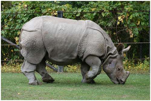
Parts of today's national park and World Heritage Site have been protected since the early 20th century. Krakatoa island was declared a Nature Reserve in 1921, followed by Pulau Panaitan and Pulau Peucang Nature Reserve in 1937. The Ujung Kulon Nature Reserve has been established in 1958 followed by the Gunung Honje Nature Reserve in 1967. Ujung Kulon National Park has been established in 1992. In 2005 the park has been designated as an ASEAN Heritage Park.                
                                                                                                                                                                     

Declared by Minister of Forestry and Estate Crop No. 758/Kpts-II/1999, September 23, 1999.

Meru Betiri


Meru Betiri National Park is national park in the province of East Java, Indonesia. Located at the geographic location 8o21- 8o34' South and 113o37' - 113o58' East. Extending over an area of 580 sq km of which a small part is marine (8.42 sq km). The beaches of the park provide nesting ground for the Endangered Leatherback turtles, Hawksbill turtles, Green turtles and Olive Ridley turtles.

Meru Betiri National Park takes its name from 'Gunung Betiri', the highest mountain in the region at 1,223 m. The main highlight of the park is its extensive lowland rainforest as well as lowland swamp forest and many beaches. The Javan tiger used to live in Meru Betiri National Park and the massive Rafflesia Flower can still be seen today.

Meru Betiri National Park has a varied topography reaching from a plain coast to highland with an altitude of almost 1,200 meters. The tallest mountains within the park are Mount Gamping (538 m asl), Mount Butak (609 m asl), Mount Sukamade Atas (801 m asl), Mount Gendong (840 m asl), Mount Mandilis (844 m asl) and Mount Betiri (1,192 m asl). 

The topography along the coast is generally hilly to mountainous. There are only few sandy plain coasts, most of them located in the west, such as Rajegwesi Beach, Sukamade Beach, Permisan Beach, Meru Beach and Bandealit Beach. Some rivers across Meru Betiri National Park are Sukamade River, a perennial river, Permisan River, Meru River and Sekar Pisang River that flow to the south coast.

The Meru Betiri area is influenced by monsoon wind. During November to March, the westerly wind brings rainfall to the area, whereas the dry season occurs during April to October. The average annual rainfall is between 2,300 and 4,000 mm, with 4 dry months and 7 wet months in average.

As a result of its diverse topography, Meru Betiri National Park contains five distinct vegetation types: 

  • Coastal vegetation, found around Sukamade Bay and Meru Bay. This vegetation includes the Barringtonia asiatica, Calophyllum inophyllum, Hibiscus tiliaceus, Terminalia catappa, and Pandania tectorius.
  • Mangrove vegetation, found at the eastern side of the Rajegwesi Bay as the outlet of Lembu and Karang Tambak Rivers, Meru Bay and Sukamade Coast. The dominan vegetation are Rhizophora, Avicennia and Bruguiera. At the outlet of the Sukamade River, there is Nypa fruticans.
  • Swam vegetation, found at the back of the mangrove forest of Sukamade. Some tree species here are Manilkara kauki, Gluta renghas, Alstonia scholaris, and Sterculia foetida. 
  • Lowland tropical rainforest, including among others tree species of Pterospermum, Tetrameles nudiflora, Ficus variegata, Diospyros cauliflora, Aglala variegata, Dracontomelon mangiferum, Bischoffia javanica, Dysoxylum amoroides, Gossampinus heptaphylla, Litsea, and Plectocomia elongata.
  • Rheofit, found in the wetland areas, such as the Sukamade area. The dominant vegetation species here is the Saccharum spontaneum.
Conservation efforts are primarily concentrated on the nearby turtle nesting beaches, particularly at Sukamade, where  the turtles are monitored and protected during egg laying. Green, Leatherback, Hawksbill, Olive Ridley and Loggerhead  turtles uses the same beaches   Visitors can also see turtles laying their eggs on beaches near Sukamade. Many people also take in Sukamade Beach when visiting Meru Betiri National Park, while Alas Purwo National Park is also worth a look. The park office organizes trek through the national park and there are several guesthouses in the area.


Declared by Minister of Forestry No. 277/Menhut-VI/1997, May 23, 1997.

Kepulauan Seribu


Kepulauan Seribu (Thousand Islands) is the only regency of Jakarta, Indonesia. A string of 105 stretching 45 km north into the Java Sea, with the closest lying in Jakarta Bay only a few kilometres of mainland Jakarta.

Kepulauan Seribu National Park, with a total area is 107,489 hectares,  located at the geographical location is 106o25' - 106o37' E, 5o23' - 5o40' S, temperature 21oC - 34oC, rainfall 3,000 mm/year (on average).

The Kepulauan Seribu chain is a place of enchanting natural beauty. The simphony of calls of the creatures on these small green islands, combined with the sound of thundering wafes and golden sunshine at dusk bring a sense of calm and tranquility to all those who visit the park.

The 78 coral islands, both large and small, with an average altitude of not more than 3 m asl, form a chain. Hundreds of year ago, the islands were formed upon colonies of dead coral. These colonies initially grew on shallow sea beds, their upper layer breached the surface and were weathered. Later, pioneer plants such as bushes and several tree species began to grow on the coral. The surface of the islands is quite different from soil-covered ground, and this is reflected in their diverse plant and animal life.

In general, the plants that grow in the park are dominated by coastal species like coconut palm (Cocos nucifera), pandan (Pandanus sp.), cemara laut (Casuarina equisetifolia), cangkudu (Morinda citrifolia), butun (Barringtionia asiatica), mangrove (Bruguiera sp.), sukun (Artocarpus altilis), ketapang (Terminalia cattapa) and kecundang (Cerbena  adollam).

Sea vegetation commonly found in the park consist of seaweed like Rhodophyta, Chlorophyta, and Phaeophyta as well as classes of sea grases like Halimeda sp., Padina sp., Sargasum sp., and Caulerpa sp.

The dominan animals in the park include 54 sea biota species which form part of the coral reef ecosystem, 144 species of fish, 2 species of giant clam, 6 species of sea grass, sea worms of various colours and 17 species of coastal bird.

The park forms a hatching site for Hawkbill Turtle (Eretmochelys imbricata) and Green Turtle (Chelonia mydas). The Hawksbill Turtle is an endangered species and is rarely found in other waters. These turtles are bred on Pramuka Island. This activity is aimed at recovering the turtle population, which had almost reached extinction. Breeding activities include egg hatching in a semi-natural way and caring for the baby turtles till they are readi to be released into their natural habitat.

Most coastal areas of this park surrounded by mangrove forest, where iguanas, golden ring snakes and phytons can be found.

In 1972 Ali Sadikin, then governor of Jakarta, declared Onrust Island a protected historical site. In 2002 the administration made Onrust and its three neighbor : Cipir, Kelor and Bidadari  an archaeological park to protect the artifacts and ruins on the island that date back to the time of the Dutch East India Company.

The Onrust Archaeology Park consist of four islands that are relatively close to Jakarta, within at most two kilometers from each other and that form a rough square.


Declared by Minister of Forestry No. 6310/Kpts-II/2002, July 13, 2002.

Karimunjawa


Karimunjawa National Park, also Karimun-Jawa National Park, is a national park designated in the Karimunjawa archipelago, Jepara regency, Central Java, Indonesia, at least 80 km north-west of Jepara, Central Java in the Java Sea.  The national park was formally declared as Marine Protection Area in 2001. Based on popular local myth, this archipelago was discovered by Sunan Nyamplungan, the nephew of Sunan Kudus who is one of the Wali Sanga

Karimunjawa is also a tourist attraction popular for its white sandy beach, pristine coral reefs, challenging treks through the hills, the pilgrimage to Sunan Nyamplungan Cemetery, and the customs and traditions of the Karimunjawa Community.

The Karimunjawa archipelago lies from 5o49' - 5o57' South latitude and 110o04' - 110o40' East Longitude in the Java Sea, north of Java. It is about 120 km from Semarang, the capital of Central Java Province. Comprising 27 islands, the Karimunjawa subdistrict is divided into three villages, namely Karimunjawa, Kamujan and Parang. The archipelago is under the administration of Jepara Regency, Central Java Province. Karimunjawa archipelago covering 111.625 ha in 2001, and area of 110.117,30 ha was declared as Marine Protection Area (MPA).

The geological formation in the archipelago is mostly dominated by quartz sand stone, gravel, mud, and clay. The topography of Karimunjawa Marine National Park is a wave of low land, with elevation ranging from 0 - 506 above sea level. Gajah hill is the park's highest point. Temperature range from 30 - 31oC.

The biggest island in the archipelago is Karimunjawa island, town or villages are located in Karimunjawa. Kemujan, Nyamuk, Parang and Genting island, the other island are uninhabited.

Karimunjawa's coral reefs are made up of fringing reefs, barrier reefs and several patch reefs. They have an extraordinary wealth of species 51 genera with more than 90 species of coral biota and 242 species of ornamental fish. Two protected biota species, black coral (Antiphates sp.) and Organ pipe coral (Tubipora musica), can be found here. Other protected sea biota include the hornet helmet (Cassis comute), Triton trumpet (Charonia tritonis), Chambered nautilus, Green shell (Turbo marmoratus), and six species of clam. Around Kemujan island, the wreck of the Panamanian ship Indono, which sank to the sea bed in 1955, is now a habitat of coral fish and is a polular site for wreck diving.

A total of 300 ha of mangrove forest covers the national park, and is the habitat for 13 genera and 32 species of mangroves, such as the Rhizophora mucronata.

The lowland tropical forest covers an area of 1.285,50 ha. It provides habitat to a number of endemic species including the Mythical Dewadaru tree (Fagraea elliptica), Setigi (Pemphis acidula) and Kalimasada (Cordia subcordata). The local people use these trees as raw material for souvenir handicraft such as for tasbih, kris or staffs. It is generally believed that the wood of the endemic Dewadaru trees has a legendary power or curing diseases or snake bite wounds, protecting house from thieves, or prolonging life. Recently, the population of these three tree species has deteriorated because of the increased extraction.

There are about forty different bird species in the island, including the Green imperial-pigeon (Ducula aenea), Yellow-vented bulbul (Pycnonotus goiavier) and Red breasted parakeet (Psittacula alexandry). Some migratory birds are also found in this area, such as the Common sandpiper and Whimbrel. The lowland tropical rain forest is the natural habitat of the rare White-hellied sea eagle. The latest expedition report of the Indonesian Science Institute reveals that there are two endemic butterfly species, and these are the Euploea crameri karimodjawaensis and the Idea leuconoe karimodjawaensis.

Based on the functions, Karimunjawa National Parks was divided into four zones  :

  • Sanctuary Zone (1.299 ha),  a no take zone consisting of Burung and Geleang island. Research and education is permitted.
  • Wilderness Zone (7.801 ha), research is permitted and tourist activity is limited, it consist of Krakal Besar, Krakal Kecil, Menyawakan, Cemara Besar, Cemara Kecil, Bengkoang and part of Karimunjawa and Kemujan island.
  • Utilization Zone (4.431 ha), consist Menjangan Besar, Menjangan Kecil, Kembang, Kembar, Karang Katang, Karang Kapal, Parang, Karimunjawa and Kemujan.
  • Buffer Zone (98.093,5 ha), comprises Karimunjawa, Kemujan, Parang and Nyamuk. These islands are inhabited.
The population of Karimunjawa District is 8.842, most of whom are fishermen. Karimunjawa community consist of many ethnic groups such as Javanese, Madurese, Bugis, Mandar and Luwu. The Javanese people are popularly known for their agricultural activity and their production of household utensils. The Bugis are known for their seafaring activity, and naturally they are associated with fishermen. The Madurese are known their salted fish production. They live in harmony and have created a new behaviour and tradition.


Declared by Minister of Forestry No. 78/Kpts-II/1999, February 22, 1999.

Merbabu


Gunung (Mount) Merbabu National Park (GMNP), which lies on the geographical location between 7o27'13" S latitude and 110o26'22" E longitude, with maximum height 3.142 m above sea level. It covers an area of 5.725 hectares and located in Central Java Province, Indonesia. Merbabu National Park shares its borders with Boyolali regency to the east and south, Magelang regency to the west, and Semarang regency to the north.

Merbabu Mountain is a dormant stratovolcano in Central Java. The name of Merbabu could be loosely translated as 'mountain of Ash' from the Javanese combined words : Meru means 'mountain' and awu or abu means 'ash'.

The active volcano Mount Merapi is directly adjacent on its south-east side, while the city of Salatiga is located on its northern foothills. A 1.500 m high broad saddle lies between Merbabu and Merapi, the site on the village of Selo and highly fertile farming land.

There are two peaks o Mount Merbabu, namely Puncak Syarif (3.119 m asl) and Puncak Kenteng Songo (3.142 m asl). These peaks cam be reach from Kopeng, Salatiga regency (Tekelan Track) with the distance about 6,25 km.

One of the forestry research centers nearby, Balai Penelitian Kehutanan Solo, in its research in 2008 reported that the GMNP is mainly dominated by shrub. According to the research this shrub land spreads from the middle to the top slope of the mountain. The presence of some grasses on the top part of the slope region is also included in the report.

The climate classification proposed by Schmid and Fergusson is the most widely used in Indonesia categorizes as wet climate (zone B), with value of Q = 31,42 %. The annual rainfall in the area is 2.000 - 3.000 mm per year, while the average annual temperature range between 17o C to 30o C.

The vegetation type in this park has been generally divided into Low mountain forest (1.000 - 1.500 m asl), High mountain forest (1.500 - 2.400 m asl), and Sub alpine mountain forest (2.400 - 3.142). GMNP host a lot of flora and fauna life. Some of the plant species which are found in the park are Pinus merkusii, Acacia decurens, Schima noronhae, Albizia montana, Quercus sp., Engelhardia serrata, and Podocarpus sp. There also mammal such as Herpates javanica (Java Civet) and Macaca fascicularis (Long-tail Monkey).

Based on Aves Inventory (Balai Taman Nasional Merbabu, 2007) by GMNP agency, 52 species of birds were found in GMNP, such as Picnanotus aurigaster, Lanius schach, Picoides macei, Dichrurus leuchopeus, Pericrocotus miniatus, Halcyon cyanoventris, Streptopeli chinensis, Tracypithecus auratus, Spizaetus bartelsi, Ictiaetus malayaensis, Corvus enca, Falco sp., Zoosterops montanus, and Parus mayor which are residing in the national park.

Generally, land use in Merbabu Mountain can be categorized into two groups :
  • Irrigated rice field on the western slopes, whit plenty springs and permanent rivers. Forest are dominated by dense Pines with shrub on the peak of slope.
  • Maize and tobacco plants on the eastern of the slopes, with small springs. The forest area is dominated by Pines with very small shrub on the peak of slope.

There are 37 villages, 7 sub districts, and 3 regencies with approximately 116.385 people and 31.725 household living surounding the national park. These people have more or less the same standard of living and socio-economic status. Roughly 87,47 % of the local people earn their living through farming rice, vegetables such as onion leaves, potatoe, cabbage, maize and celery, and fruits such as strawberry. Furthermore, almost every household has livestock such as cows and goats.


Declared by Minister of Forestry No. 135/Menhut-II/2004. May 4, 2004

Merapi


Mount Merapi National Park (Taman Nasional Gunung Merapi -TNGM) covers an area of 6.410 hectares, is an active stratovolcano located on the border of between Central Java and Yogyakarta, Indonesia. It is the most active vulcano in Indonesia and has erupted regularly since 1548, it is located approximateli 28 kilometres (17 mil) north of the large Yogyakarta city, and thousands of people live on the flanks of the volcano, with village as high as 1.700 metres (5.600 ft) above sea level.

Merapi is very important to Javanese, especially those living around its crater. As such, there are many myths and beliefs attached to Merapi.

The name of Merapi could be loosely translated as "Mountain of fire". The etymology of the name came from Meru-Api; from the Javanese combined world Meru means 'mountain' refer to mythical mountain of Gods in Hinduism, and Api means 'fire'.  Smoke can be seen emerging from the mountain top at least 300 days a year, and severel eruptions have caused fatalities. Hot gas from the large explosion killed 27 people on November 22, 1994, mostly in the town of Muntilan, west of the volcano. Another large eruption occured in 2006, shortly before the Yogyakarta earthquake. In light of the hazard that Merapi poses to populated areas, it has been designated as one of the Decade volcanoes.

Merapi is the youngest in a group of volcanoes in southern Java. It is situated at a subduction zone, where the Indo-Australian Plate is subducting under the Eurasian Plate. It is one of at least 129 active volcanoes in Indonesia, part of the volcano is located in the Southeastern part of the Pacific Ring of Fire - a section of fault lines stretching form the Western Hemisphere through Japan and South East Asia. Stratigraphic analysis reveals that eruption were typically effusive, and the out flowing lava emitted was basaltic. Since then, eruptions have become more explosive, with viscous andesitic lavas often generating lava domes. Dome collapse has often generated pyroclastic flows, and larger explosions, which have resulted in eruption columns, have also generated pyroclastic flows through column collapse.

In late October 2010 the Center of Vulcanology and Geological Hazard Mitigation, Geological Agency (CVGHM) - Pusat Vulkanologi & Mitigasi Bencana Geologi, Badan Geologi (PVMBG), reported that a pattern of increasing seismicity form Merapi had begun to emerge in early September.

Observers at Babadan, 7 kilometres west and Kaliurang, 8 kilometres south or the mountain reported hearing an avalanceh on September 12,2010. On September 13, 2010 white plumes were observed rising 800 metres above the crater. Lava dome inflation, detected since March, increased from background level of 0,1 milimetres to 0,3 milimetres per day to a rate of 11 milimetres per day on September 16, 2010. On September 19,2010 earthquakes continued to be numerous, and the next day CVGHM raised the Alert Level to 2 (on a scale 1 - 4). Lava from Mount Merapi in Central Java began flowing down the Gendol River on October 23 - 24, 2010 signaling the likelihood of an imminen eruption.


On October 25, 2010 the Indonesian government raised the alert for Mount Merapi to its highest level (4)  and warned villagers in threatened areas to move to safer ground. People living within a 10 kilometres zone were told to evacuate. The evacuation order affected at least 19.000 people, however, the number that complied at the time remained unclear to authorities. Officials said about 500 volcanic earthquake had been recorded on the mountain over the weekend of October 23 -24, 2010, and that the magma had risen about 1 kilometre below the surface due to the seismic activity.


After a period of multiple eruptions considered to exceed the intensity and duration of those in 1872. On November 10, 2010 the intensity and frequency of eruptions was noticed to subside. By this time, 153 people had been reported to have been killed and 320.000 were displaced. Later the eruptive acivities again increased requiring a continuation of the Level 4 alert and continued provision of exclusion zones around the volcano. By November 18,2010 the deat toll had increased to 275. The toll had risen 0 324 by November 24, 2010, and National Disaster Mitigation Agency (BNPB) explained that the death toll had risen after a number of victim succumbed to severe burns and more bodies were found on the volcano's slope.


Declared by Minister of F0restri No. 134/Menhut-II/2004. May, 4, 2004.